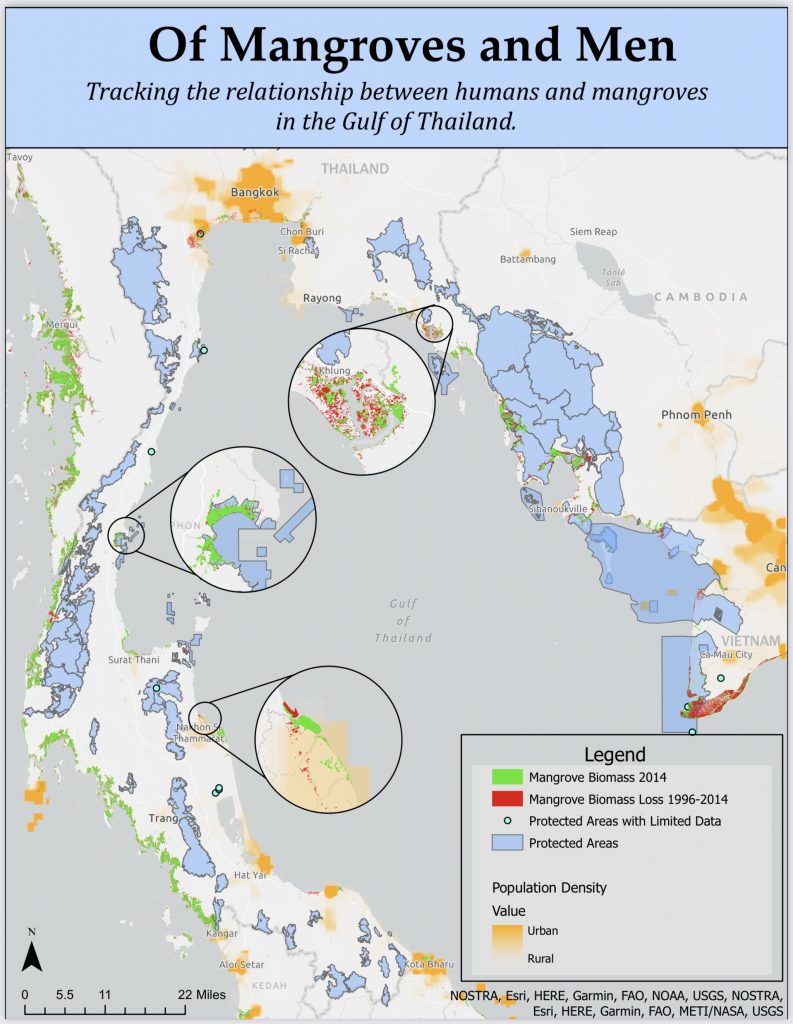
Working with a group of collaborators, I determined areas of mangrove loss in the Gulf of Thailand from 1996 to 2014. This project was accomplished entirely via remote teamwork during the pandemic, requiring extensive scheduling and task tracking. While other team members contributed valuable datasets covering marine protected areas and population hotspots, I made use of satellite-based spectral-analysis imagery to develop maps of mangrove coverage from both years and utilized geospatial processing tools to determine areas of loss and retention for these critical trees.